
Follow an Omaha Street
Use the Omaha address in the form printed on the source, then keep a normalized version beside it. A present-day Omaha address can lead to a parcel, while an older Omaha deed or directory may instead use an addition, lot, block, section, township, or range. The Douglas County Assessor, Douglas-Omaha GIS, LandmarkWeb, the Election Commission, and Omaha Public Library each answer a different part of the question. Ownership of Omaha property is a recorded-property question. An Omaha address-based election result is voting information, not a public name list.
- Enter the known Omaha address in the Douglas County Assessor valuation lookup when the official form is available. Save the parcel identifier, situs address, and legal description exactly as shown for the Omaha property.
- Open Douglas-Omaha GIS, locate the Omaha address or parcel, and turn on Parcels and City Limits. Compare the polygon with neighboring Omaha parcels before treating the mailing city as the municipality.
- Take the Omaha legal description, addition, lot, block, or parcel lead to Douglas County LandmarkWeb. Search recorded parties and instruments rather than assuming a current display supplies a complete Omaha chain.
- For election logistics, use the Douglas County Election Commission address lookup with House Number and ZIP. It returns Omaha voting information for the address, not the names of people there.
- When the question concerns an earlier Omaha occupant or street form, check the address entries in Omaha Public Library house-history resources. The historical volumes are described on the Omaha Directory Book.
Keep the search date with every Omaha result. An Omaha parcel boundary, a recorded transfer, and a published Omaha directory entry can all be accurate while describing different dates and relationships.
Omaha Assessor Search Fields
The official Omaha assessor landing page is the correct starting point for Omaha valuation and parcel work, but its live form was challenge-blocked during the research inspection. The Omaha field list is intentionally marked unverified where the form could not be opened. It identifies useful Omaha address-research leads without claiming that a control, filter, or result field is currently available.
| Field or result | Type | Status | Address use |
|---|---|---|---|
| Owner name | Expected name search | Likely optional, exact label unverified | Compare recorded Omaha party names, not occupancy. |
| Situs/property address | Expected text search | Likely optional, format unverified | Use an Omaha street number and name as an entry point. |
| Parcel number | Text | Likely optional, punctuation unverified | Bridge the assessor route to Omaha DOGIS and records. |
| Legal description/addition | Search or result field | Result behavior unverified | Carry an Omaha addition, lot, block, section, or tract to LandmarkWeb. |
| Mailing/tax address | Result field | Display status unverified | Keep it separate from the Omaha situs address. |
| Land, building, and total value | Result fields | Current field set unverified | Record the Omaha assessment date with any value. |
| Exemption, sketch, map, sales | Links or result fields | Public, gated, or absent status unverified | Do not infer an Omaha historical address from a current snapshot. |
Douglas County lists the Omaha assessor office at 1819 Farnam Street, Civic Center, Suite 400, Omaha, with 402-444-7457 in the research materials. Omaha in-person assistance and a narrowly framed written request for an existing Omaha non-exempt assessment record remain alternatives if the online form is unavailable. The research also lists 402-444-7060 for Omaha valuation and homestead questions. Confirm contact details before relying on them.
Omaha DOGIS Parcel Layers
DOGIS is spatial evidence for Omaha, not a people index. Its map service can put an Omaha street address beside Omaha parcels, City Limits, zoning, flood areas, council districts, special improvement districts, neighborhood associations, historic resources, subdivisions, and future land-use layers. That makes it useful for checking where an Omaha address sits and for preserving several valid Omaha geographic labels instead of forcing a single neighborhood name.
The official Omaha Planning GIS tools and maps catalog is the stable entry point when a viewer changes. Search or zoom to the Omaha property, activate Parcel Info and City Limits for Omaha, then click the parcel. Use the service legend to distinguish Omaha from nearby labels such as Ralston, Valley, Waterloo, Boys Town, Bennington, and Carter Lake. A city label in a postal address does not settle that question.
Omaha Street Record Coverage
Omaha address-keyed sources create a useful chain only when their limits stay visible. The Omaha assessor route and Omaha DOGIS provide parcel context. Omaha LandmarkWeb provides recorded-property instrument leads. City of Omaha Accela supplies permit records. The election tool supplies Omaha polling and subdivision information. Library sources add dated Omaha historical clues. None of those Omaha systems produces a complete current household roster for a named street.
| Address record | Custodian | What it can show | Access channel |
|---|---|---|---|
| Valuation and parcel data | Douglas County Assessor | Omaha parcel and property characteristics when displayed | Official lookup, office help, or request for an existing record |
| Parcel map and overlays | DOGIS / Omaha Planning | Omaha parcel geometry, limits, zoning, and planning layers | Map viewer and GIS catalog |
| Recorded instruments | Register of Deeds LandmarkWeb | Omaha parties, legal description, book/page, and image if available | Online index, counter/terminal, microfilm request, phone, email, or written request |
| Voting information | Douglas County Election Commission | Omaha polling place, ballot, officials, and subdivisions for an address | House Number plus ZIP lookup or Election Commission contact |
| Permit applications | City of Omaha Accela | Omaha permit number, type, status, dates, address, parcel, and labeled parties | Citizen Access search, account for full history, or Building & Development contact |
| Historic address leads | Omaha Public Library | Dated Omaha directory and related local-history entries | Library collection, microfilm, or staff research service |
Note: A current Omaha parcel or permit result is a dated record snapshot, so it should not be treated as proof of a person’s present address.
Omaha LandmarkWeb Address Bridge
LandmarkWeb is the Register of Deeds and Assessor portal for recorded Omaha property research. Its local Omaha index-book search uses Addition or Lands. Addition uses an autocomplete name, while Lands uses Section, Township, and Range. Select Deed or Mortgage, then use Find Index Books. Results identify the addition or S/T/R along with book number, page number, and an image link.
Index-book additions reach through 1989, while newer additions are on LandmarkWeb. Image access may require a login or permission. When an image is missing, the portal’s microfilm route lets a requester select a document type, provide the exact book and page, enter an email address, and request the image. The Register of Deeds also provides questions by phone at 402-444-7159 and email at rodquestions@douglascounty-ne.gov; an in-person counter or written request remains useful for an existing index or image.
The LandmarkWeb Addition and Lands index shows the legal-description path used when a modern address fails to produce a dependable lead.
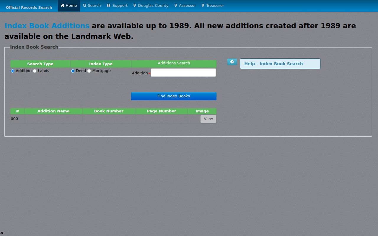
Book and page are the durable handoff between the index, a requested image, and an in-person or microfilm follow-up. They are more reliable bridge details than a guessed old street-name conversion.
Omaha Legal Description Bridge
When an older Omaha address is absent from a modern search, the strongest next step is often a legal description. A Sanborn sheet or a plat book can identify the addition, lot, and block. Those terms can then be used in LandmarkWeb, where the street name may have changed or the indexing may be organized by land description. This bridge avoids silently converting an older printed address into a modern one.
- Parcel
- A mapped unit of land used for assessment and mapping. Its shape or identifier can change over time.
- Situs address
- The physical property location carried by an assessment system. It is different from a tax mailing address.
- Plat
- A map that lays out an addition, lots, blocks, streets, or other land divisions.
- Criss-cross directory
- An address-arranged directory that can lead from a street number to a dated published listing.
Use both the raw historical address and a normalized form in notes. North/south direction, street type, unit, and even an older municipal label may matter when comparing an Omaha record with a South Omaha, Benson, township, or rural-route source.
Omaha Permit Addresses
Omaha Accela Citizen Access is the City’s permit search. Use a permit number when known. Otherwise, enter Street Number and Street Name; numbered streets may work with or without leading zeros. Permit Type, Record Status, Start Date, End Date, Street Type, Direction, Parcel No, First, Last, Name of Business, and Expand Search Additional Criteria can narrow a result.
Permit records can display a record number, type, status, application, issued and completed dates, street address, parcel, description, applicant, contractor or business, contacts, fees, inspections, and attachments. A labeled applicant or contractor is not automatically the owner or occupant. A free Citizen Access account is needed for complete application and status history, and public search may reveal only a summary or current status.
The displayed permit search comes from the official Omaha Accela permit portal, which is the proper source for checking the exact field labels before a search.
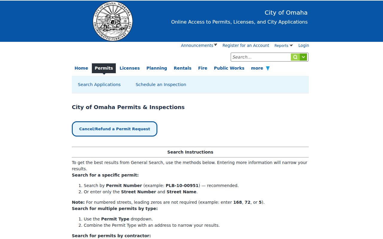
For help beyond the public search, research materials list Omaha Building & Development at 1819 Farnam Street, Suite 1100, 402-444-5350, and permit.info@cityofomaha.org. Confirm the current contact and hours before visiting or submitting a request.
Omaha Street Naming Rules
A modern map should not be used to invent an old street-name date. Omaha’s municipal process for renaming a street requires a Planning application, a petition signed by at least 60 percent of owners abutting the segment, a $1,000 fee, and an ordinance amendment. The Omaha Public Ways code is the place to document a particular change.
Earlier local records can use section, quarter-section, addition, or road language rather than a current street address. A current parcel may also join or split a historical lot. Match the source date first, then look for an authoritative map, index, or address-history record before connecting the old and current forms.
Omaha Street Directory Limits
An address search can establish only the fact supplied by its source. LandmarkWeb records an instrument and its parties. The assessor may display property characteristics and a mailing contact. Accela records permit roles. The Election Commission tool takes House Number and ZIP and returns voting information, not a person search. Nebraska Revised Statute §32-330 restricts copying, use, and internet posting of voter-file information.
Confidential-address participants, sealed records, private contact details, and full household information are not an address-directory target. A tax mailing address can belong to a trust, bank, manager, attorney, or earlier contact. Treat each result as a source-specific lead, and never combine gaps into a claim about who is at an address.
Lawful personal use. Omaha address records are for careful, personal research within the limits set by each custodian. Do not use them to stalk, harass, intimidate, or target any person.
Omaha Address Request Routes
When an online screen does not answer the narrow question, ask the office that holds the existing record. Nebraska’s Attorney General public-records guidance explains that a request may seek inspection or copies of a non-exempt existing record, but it does not require an agency to create a new address list or database. Identify the department, record type, date range, address or parcel, and preferred format.
For recorded instruments, use LandmarkWeb, its counter or microfilm route, and the Register of Deeds contact. For historical address work, Omaha Public Library offers its collections, microfilm, and a limited research-help service. For a city-held permit, use Accela and Building & Development. State the exact parcel, book/page, permit number, or date range whenever possible. That gives the custodian a reproducible request and keeps a street directory search tied to actual Omaha records.
Note: Record the portal, search terms, date, filters, result count, and any login barrier when a search produces no match.